Thursday, December 15, 2011

2011 Year in Review

As 2011 draws to a close I find myself contemplating how to make a year review post while trying to avoid the narcissistic perils that seem to go with these things. It might be unavoidable but, on the other hand, this last year has been perhaps the greatest of my life and a quick step back to review makes me realize just how fortunate I am. Compare this with my life three years ago - things were very different. Back then I felt like I was circling the drain just as I started to get on my feet out of college. My job, marriage, house... all seemed at risk. And while I did end up spending five months unemployed, unable to get any company to even give me a call back, I eventually landed my dream job, mended important personal relationships, and rescued my life on many fronts. I suppose this is also a thank you of sorts to all the family, friends, and strangers who've helped and supported me along the way.

So, with that said, here's what I have to show for the last 365 days...

In January I flew to Salt Lake City for work where I managed to sneak in some pre-dawn runs (it helps to still be on east coast time) in the canyons and hills overlooking the city. Often the moon was so bright on the snow I didn't need a headlamp.


In February I set a personal record at Rocky Raccoon 100 in Texas. Later that same month I spent a few days in Baxter State Park in Maine and climbed Mount Katahdin.


In April I tried (and failed) to break 4 hours in the 50k at the TARC Spring Classic, but I happened to win the race in the process.

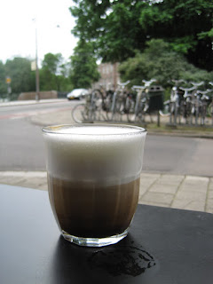
In May I broke 24 hours at the Massanutten Mountain Trails 100 and came in 9th place. The day after getting back I flew to the Netherlands for work, my first time in Europe. There, I got to drink a good cappuccino and watch the world go by at a sidewalk cafe...


...explore an abandoned German bunker on the beach of the English Channel near Calais, France...


...live out a lifelong dream driving over 100 MPH on the German Autobahn with the gas pedal all the way to the floor (a Citroen 3-cylinder, 0.9 liter motor turning 7,000 RPM wails like a clogged vacuum cleaner, in case you were wondering)...


...and wander the streets of Amsterdam for a day.


Most of what you've heard about Amsterdam is true.


And they do love their bicycles.


In June I managed to break the Fastest Known Time for the Pemi Loop and in July made a valiant attempt at the FKT for the Presidential Traverse.


In August I shared an epic run of the length of Maine's One Hundred Mile Wilderness with my good friend Ryan.


In September I got to explore some more of the West, through Yellowstone...


...the Beartooth Highway...


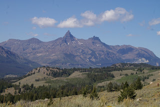
....and Grand Teton National Park.


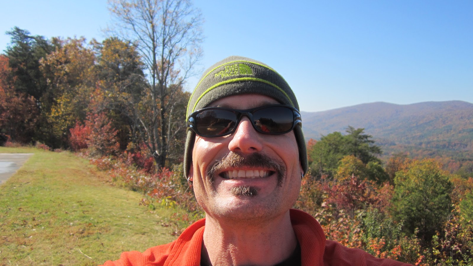
Then, on the same trip, I placed eighth and was inducted into the Royal Order of the Crimson Cheetah at the Wasatch Front 100.


In October I ran my dog, Cooper the poodle, around the Pemi Loop (with West Bond and Galehead) in under 10 hours to finish his 4,000 footers. I also tried and failed miserably to break the 3 hour barrier at the Bay State Marathon in Lowell, Massachusetts.


November brought me to Alabama where I ran my fifth hundred miler of the year on the Pinhoti Trail.


And finally, in December I turned 30 years old and started noticing a few gray hairs, though did get carded when I went out for dinner on my birthday. I suppose it'll be easier fool people into believing I'm responsible adult now.


By the time December 31st actually rolls around I'll have run over 2600 miles for the year. This works out to an average of 50 miles per week, every week, and over 500 miles more than 2010. In races, I racked up over 700 miles which has taught me a great deal about my capabilities but also took a cumulative toll on my body that will take some time to recover from.

Re-reading this post, I have to say I'm not sure what I did to deserve such a good year. There were, of course, low spots which don't need to be mentioned here, but overall it was one of the greatest of my life and I can honestly say I did my best to enjoy and appreciate the good fortune while I've had the chance. There are plenty of adventures already planned for 2012, but 2011 will be hard to top.

Thursday, November 10, 2011

2011 Pinhoti 100

Most of my races I first hear about through word of mouth - Massanutten, Vermont, and Wasatch all have reputations that precede them and come with recommendations from friends. Pinhoti was a little different. Browsing the race schedule on Stan Jensen's run100s.com, I stumbled across Pinhoti and everything about it appealed to me. In early November, it fell outside the normal ultra season, so there wouldn't be any scheduling conflicts. It's in Alabama, a part of the country I've never been to before and I'm interested to see for myself. And finally, it sounded like a legitimately interesting course; 100 miles point-to-point route on the Pinhoti National Scenic Trail, with a healthy focus on single-track through the Talladega National Forest. Why not? And just like that, I committed to my fifth hundred miler of 2011.

Coming off a very strong finish at Wasatch eight weeks earlier, I have to admit that I had pretty high expectations for myself at Pinhoti. At the pre-race meeting I was a little shocked to find out that other people knew who I was and had high hopes for me as well. A bit to my chagrin, the words "18 hours" got thrown around a little. Still, visions of a podium finish were hard to ignore even though I haven't really felt 100% since coming back from Utah. In the end I just wanted to run my own race and settled on a loose goal of sub-20 hours, with lots of wiggle room for my position on the field and how I was feeling.


My good friend Nate, volunteered at the last minute to crew and pace me and I'm not sure what I would have done without him. I was originally planning on going down alone and using drop bags, but I jumped at the chance to have a familiar face along. This would speed up my aid station changes and, perhaps most importantly, provide me with a familiar face to look for. As corny as it sounds, hundred milers still tend to break me down a bit emotionally and encouragement from my crew at each aid station is sometimes the only thing that keeps me going. I've traveled with Nate for runs before and as another ultrarunner, he knows how to play the game and could relate to what I'd be going through. I had no idea how crucial he'd turn out to be later in the race.


It was 40 degrees and pitch black at the 6 am start at a campground in Heflin, Alabama. I was already feeling grateful for Nate's help, as I was able to wear my down parka right up until the very last minute before the race director said "go!" Go out easy, see where the first 25-50 miles get you, then make your move if you've got it, I told myself.  I say that every damn race and it didn't work this time either. Running onto the first section of the Pinhoti Trail  I was virtually on Karl Meltzer's heels, a place I didn't really have any business being. He began to pull away but I stuck in the middle of the chase pack with about 4 or 5 other guys at what honestly felt like an easy enough pace. This isn't so hard, of course I can do this all day.


We made quick work of the first few miles of trail and as it got light out, I was impressed at quality of the course. Smooth, rolling singletrack covered in leaves, and never too steep to run easily. In fact, it felt shockingly similar to the mountain bike trails I train on in southern New Hampshire, with only some odd looking plants to give it away. Every time we approached a steep hill the mountain runner in me slowed down a bit, expecting to be sent up by the steepest course possible, only to switched-backed off. Nearly every hill was like this for the duration of the race, always approached gradually, never directly, with lots of switchbacks and long traverses. One thing I found a little odd, though not unpleasant, was that the trail would often take a long, gently rising traverse for half mile or so up a drainage, cross the stream near its head, then gently traverse back down the other side. Only a couple hundred yards away through the woods, you could see the trail you'd been on nearly a mile ago.

Our pack began to lean out a bit and I was suprised to find myself in second place as we went through an area that looked like it had been clear-cut. Dead stumps and brush were everywhere, with an increasingly hot sun beating down as the temperature rose into the upper 60s. I noticed that most of the stumps had been uprooted from the ground before being chainsawed off and figured this must be the tornado area I'd read about in other race reports. The complete destruction was impressive.

The second aid station is located right next to a set of railroad tracks and as I approached I could hear the sound of a train coming. I grabbed a couple items as the volunteers urged me to get going before the train arrived. I sprinted out to the tracks where the train was only a few hundred feet away, but luckily for me it was moving slowly and I was able cross safely. Nate later told me that it was so long that it took nearly five minutes for the whole line of cars to go by, stranding a few runners for what must have felt like an eternity.

At aid station 3, I was still holding up pretty well but beginning to feel fatique creep into my legs, much earlier than I would have liked. Nate changed my bladder out like a pro, said a few encouraging words, and took the time to do the little important things, like make sure my bladder tube was routed the right way to keep it from getting kinked or chafing my back anywhere. I got a burst of adrenaline as more people began to filter into the station and tried to leave before Nate was finished. He litteraly held me in place by my hydration pack so he could finish what he was doing.

The urgency didn't last too long, as I realized that I just didn't have a stellar performance in my legs today. I'm  not sure whether it was the cumulative effects of so many race miles this year, but my training was more focused on recovery from Wasatch than than actually building up my capabilities. I began to walk more and more as several people passed and didn't make any effort to chase them down. I kept reminding myself that I was damn fortunate to be where I was, even a year ago I'd have had a hard time believing that I'd ever be in the top 10 at hundred mile race. Hiking the gentle grade up to the top of Mount Cheaha brought me to a little over 2,000 feet and the highest point in Alabama, with a decent view from the top. Nate met me again and knew all the right words to say. He knew how I was beginning to struggle, but I tried my best not to externalize any specific aches or pains, mostly because I didn't want to acknowledge them to myself.


Coming down the backside of Cheaha was a notorious section of trail known as the Blue Hell. I didn't find it to be quite that exactly, moderately rocky like you'd find in the White Mountains, but pretty manageable. Still, it was easily the most rugged footing on the course. From the bottom, a stretch of pavement and some jeep roads led me back onto the Pinhoti Trail.

It got dark for me somewhere around mile 60 and I began to get lonely. At first, I hadn't anticipated needing a pacer, but by the time I got to Porters Gap at mile 68, I asked Nate to come with me. We shuffled along together in the dark, alternating between animated conversation and me being sullen and quiet, Nate took it all in stride. I was walking more and more, a little disappointed with myself, but I kept trying to remember there were a whole lot of people behind me who'd be grateful to be this far ahead. At a few points I showed more weakness than I would have liked, stopping to rest with my hands on my knees and groan for a bit. Nate responded with his peculiar method of motivation, "get moving or I'll get in front of you and fart."

We ran along for a while on some sort of ridge line as the temperatures dropped and the wind picked up and whipped through the trees. Each aid station was a little oasis in the night with, campfires, friendly faces, food, and a little shelter from the wind. I was a bit disoriented as to where we were, I hadn't memorized the names and mileages of the aid stations and I'd somehow managed to misplace my pace chart. Each time we arrived I'd get confused about how far we had to go and how badly our pace was retreating. At one station, the volunteers were actively struggling to keep their EZ-up tent from blowing away. It would flap and jump around violently, threatening to upend the food table it was anchored too, Gatorade coolers and all. We made sure to thank the guys for their time, especially on a night like this.

The miles dragged on, but eventually we came down off the ridge line and out of the wind. A long series of dirt roads brought us through the final aid station and back onto pavement where a long straight uphill stretch led into downtown Sylacagua, Alabama. There was a headlamp visible ahead of me, and one behind, but I didn't really have the wherewithal to chase one down, or run hard to escape the other, and we entered the  football stadium that marked the finish. 200 meters around the track and hundred-miler number seven was in the books in 22:49:57; good enough for 10th place.


With its own little niche cut out, I can see the Pinhoti 100 going places in the future. It has the right combination of a great course, excellent organization, accessibility, and scheduling that I'd be happy to recommend the race to anyone. I'm not sure how next year will play out for me but, not feeling like I ran the best race I could run, I feel like I have unfinished business here. Maybe I'll be back to settle the score.

Thursday, September 15, 2011

2011 Wasatch 100

The Wasatch Front 100 Mile Endurance Run; my first western race and (almost) the most challenging course I've encountered. As a runner from low (but not flat!) New Hampshire, I really didn't know what to expect. With 27,000 feet of elevation gain, altitudes of over 10,000 feet, and steep climbs and descents called intimidating things like Chinscraper, the Grunt, the Dive, and the Plunge how would I, as an east coast lowlander fair? As it turned out, this race was right up my alley.

As with all hundred milers, a lot of people went into the race with big dreams of running a sub-24 hour pace and I knew that the majority of them would be humbled. I had those same dreams, but realized they were one hell of a stretch goal. Even more ambitiously, I secretly coveted a top 10 finish. I just hoped that my training, preparation, and planning would let me be one of the lucky ones.

The race started with little fanfare from East Mountain Wilderness Park in Kaysville, Utah. The first few miles were on the rolling double track of the Bonnevile Shoreline Trail and I found myself expiencing the same familiar feeling I get at the start of all my hundred milers. Aren't we going too fast? Why are there so many headlamps in front of me? Maybe sub-24 isn't in the cards today. Should I be worried about that little twinge in my hamstring? Do I have rocks in my shoes already? It always plays out the same way and I can do nothing but let the race come to me on it's own.

The trail we were running on was very dry and so much dust was being kicked up by the hundreds of running feet that it looked like fog in the beam of my headlamp. The dust began to cling to my skin, already damp with sweat and I was glad when we turned onto the first steep climbs of the day and the pace slowed. Just like the start of a Presidential Traverse, we went up over 4,000 feet in only a few miles, and I felt right at home.

By the time we topped out on Chinscraper it was fully light out and we were treated to a gorgeous panorama of the Salt Lake City valley below. I tried hard balance gawking at the view with running the winding singletrack through an open grassy sagebrush area. The trail was overgrown by thigh-high brush at times and I had to tolerate a lot of scratching and scraping on the bare skin of my legs. I lost a bit of blood through here but no worries, I told myself, all this dust will help things clot right up! Despite all this, I was able to make good time to the first water stop at Groebben's Corner at mile 13.

Onward to Francis Peak, where a stiff breeze made it tricky to make meaningful forward progress and I was often blown off the side of the trail. Things got a bit chilly and I was glad to have brought a thin pair of fleece gloves along. Descending the peak was a long and steep dirt road that I had been forewarned about. Many people hammer down this section in an effort to bank time, but end up frying their quads instead. I made an effort to take it easy and arrived at the bottom in good shape, having lost a few positions in the process. Oh well, it was still much too early in the race to worry about that. Quick aid station visits and some more fast singletrack would help me move up through the ranks soon enough.

The section leading up to the Boutiful B station (mile 24) was a bit of an adventure. Much of the course was on rough and overgrown deer trails. Often the brush was over my head and there were many blow-downs to clamber over, around, and under. While there was a lightly beaten footbed to follow, this was clearly an unmaintained section and some route finding skills were helpful. Again, my experience bushwhacking in the White Mountains served me well and I was able to push through without losing much time.

I reached Big Mountain aid station at mile 40 still feeling strong. This would be the first station my support crew could get to due to extensive construction and storm damage to access roads on the early part of the course. The atmosphere at the station was full of energy  and noise. There were so many cowbells, airhorns, and other noisy things that it sounded like a one man band falling down a few flights of stairs. I was happy to see my family who'd flown out to Utah for vacation, but only for a few moments. Not lingering long, I was soon on my way and passed the eventual women's winner Becky Wheeler on a small uphill. Shortly afterward I caught up to Jared Campbell who I'd leapfrog with for the next 15 miles or so. He offered me some valuable advice about being conservative in the heat of the day, the layout of later parts of the course, and even saved me from taking a wrong turn at an unmarked junction on the way into Lamb's Canyon. Overall, with a few exceptions, I found the course markings to be sparse but adequate. This was rather refreshing, rather than having a glut of paper plates or surveyor's tape every few hundred yards, only trail junctions and a handful of confidence markers were set up.


From Lamb's to Millcreek Canyon was a tough climb for me over Bear Ass Pass. I hit a bit of a low spot here and ended up walking much of the paved road on the final approach to Millcreek (62 miles) not feeling so good. How could I be walking such a shallow uphill on pavement? Fast people don't do this. I'm slipping off a 24 hour pace, aren't I? When got to the station station I was surprised to learn that I was up to 8th place and over a half hour ahead of schedule. I realized I was being a bit tough on myself and I was still doing quite well. 

An easy climb to Dog Lake on the Upper Big Water trail led to some more singletrack, this time through beautiful groves of aspen. I encountered a few mountain bikers, all of whom were very polite, out for an evening ride, as well as a moose off in a meadow, munching on his dinner. Mmmm... dinner. Lately I've been using GU Chomps to break up the monotony of gels, but was craving solid food. A cup of chicken noodle soup and a handful of salt and vinegar potato chips from one of the aid stations hit the spot. Popping out once again on an open ridge line, I was rewarded with a crimson red sunset over the mountains beyond the Great Salt Lake. I could see Antelope Island in the middle of the lake, as well as all the lights beginning to come on in the valley, revealing the straight grid pattern of streets that's peculiar to the west. Past a rather extensive collection of antennas, transmission towers, and maintenance sheds and I followed a long downhill jeep road, turning to pavement, which led me to the lodge at the Brighton ski area at mile 75 and 10 pm.


I departed Brighton in the dark with fresh socks, an MP3 player, and some warmer clothes. Climbing up to Catherine Pass and Point Supreme, the high point of the course at over 10,00 feet, it got a bit chilly out and I could see my breath in my headlamp. I'd been running alone for quite some time and wouldn't see my family again until the finish, so it was nice to have music to keep me company. For this race my pacer would be the soft, soothing sounds of the Dropkick Murphy's, Agriculture Club, and Tool.

The last 25 miles of Wasatch are characterized as the hardest, with relentless ups and downs on loose, eroded ground. I struggled up the Grunt which was quite steep, even with switchbacks, and made my way to the top of the Dive and the Plunge. Dropping hundreds of feet down a series of steep ravines, these "trails" were horrendous. Imagine an eroded trench about a foot deep and a foot wide filled with fine sand and potato sized rocks and you'll get the idea. Thick brush on either side ruled out running anywhere but actually in the trench where it was impossible to get into a good rythm. Each step sprayed sand and gravel into my shoes and my already sore toes were constantly banged into the rocks. I knew I was doing damage to my feet and felt both my big toe nails start to wiggle loose. Occasionally I'd stub my toe (harder than usual) and the pain would make me howl out loud.

Soon enough, the trail flattened out a bit and I was approaching the last aid station at mile 93. But what's this? A set of lights behind me? They were perhaps a quarter mile back and despite my best efforts, gaining fast. I tried to drop them by blowing through the aid station but they continued to close. I'm not sure I can run like this for another 7 miles. Hammering down slopes I would have only cautiously walked a few miles earlier, I felt like I was redlining, and I continued to bleed ground. They're catching you too fast, just let them have it. But still I ran, even when I could hear footfalls close behind me and saw my shadow stretching out ahead from someone else's headlamp. A few flooded sections of trail came up and I didn't bother looking for a dry way to cross, I just splashed through carelessly. And then the we hit an uphill. I flew up it faster than I'd run any hill all day and the lights finally began to fade a little. Rounding a slight blind corner, I shut all my lights off, playing tricks and trying to convince my pursuer that I was farther ahead of them than I really was. It seemed to work until I tripped on a log and landed on my face. I fall a lot, but I don't remember ever getting dirt in my mouth before this. No time to worry about that, I got got back on my feet and was soon spit out of the woods and onto the final mile of pavement with no one else in sight. There was a strong moon to see by, I kept running hard with the lights out until I hit the finish line at the Homestead in Midway where my wife and family were waiting for me.


Success!

22 hours 45 minutes and eighth place on one of the hardest mountain hundred milers in the country; a result that I could have hardly dreamed of a day earlier. About two minutes later, ninth place came in and we congratulated each on other on putting up a good fight.

After a good night's sleep, I came back to the finish area to cheer the remaining finishers in. My good friends David and Norm both finished and completed a summer long series of hundred milers known as the Grand Slam. I was happy for then both.


With all that behind me, and a few days to reflect, I have to say that Wasatch has become my favorite course so far. While the Hundred Mile Wilderness was more difficult, it'll be hard for any race to make up for Wasatch's scenery, and the sheer pleasure of running for miles on open ridgeline singletrack. That being said, I sent in my Hardrock Hundred application today...


Sunday, August 7, 2011

100 Mile Wilderness Run - Maine Appalachian Trail

The One Hundred Mile Wilderness; a name like that is seductive to a person like me. So, when I was invited to take part in an informal run on this remote section of the Appalachian Trail in northern Maine, I jumped at the chance.

The plan was depart from Abol Bridge at the foot of Mount Katahdin and run south for 100 miles to the town of Monson. While the term "wilderness" gets loosely used here, the area is quite isolated; we'd see no pavement of buildings aside from a handful of primitive backpacker shelters. Our support crew would use the private logging roads that criss-cross the area so we could be resupplied (and kept track of) every 20 - 15 miles. Looking back now, I underestimated the difficulty of this run and my time goals were... optimistic. Coming off a strong summer of mountain running, I figured that there was at least a chance I could pull this off in under 24 hours. In any case, I was physically and mentally prepared to slug it out for as long as necessary


From the start I teamed up with my good friend, Ryan.We'd look after each other and provide some measure of safety, as well as someone to bitch to. Misery loves company, and I doubt either one of us could have done it alone.

A total of twelve runners started from Abol Bridge at 5 am, just as it was first getting light out. The trail was fairly easy, with decent footing and only mild elevation gain and we were able to cruise along at a 5 mile per hour pace that felt comfortable.


The trail wound it's way through mossy forests and over Rainbow Ledges.


There were a few outlooks from ponds and ledges, but we didn't get any views, as the humidity was high and the visibility low.


Just as we began to encounter our first hikers of the day, I felt a bug land on the back of my head, followed by a sharp stinging sensation. Swatting frantically, I let out a string of choice words which made the backpackers look at me a little funny. I haven't been sting by a bee in years, but was left with a painful welt to remind me what it felt like for the next few hours.


We reached our first checkpoint at Pollywog Gorge (mile 20) around 9 am. Things were going smoothly, except for my crew almost being run off the road by a logging truck. It's understood that these are private roads and that logging trucks have the right of way, but blitzing around a blind corner on the wrong side of the road is a bit reckless.


Photo: Ian Parlin

Next, we went up and over Nesuntabundt Mountain, our first real climb of the day, then along a river on soggy ground and past numerous lakes and ponds. Sometimes the trail went right along the shore.


By now, it was midday, the sun was out, and things were getting hot. As we ran by Jo-Mary Lake, I stopped to soak my shirt in the water. It was very tempting to go for a swim.


We hit checkpoint #2 at Jo-Mary Road (mile 41) a bit before 2 pm. After climbing over Boardman Mountain, we had a few minor river crossings to contend with.


The first 50 miles or so were a mixed bag of footing. Some sections were easy...


and some were a bit more difficult.


One of the many backpacker shelters we passed along the way.


We reached checkpoint #3, Logan Brook Road (mile 55), a bit after 6 pm. From there, it was up and over Mount Whitecap with the sun setting, then a rocky ridge run and back into the trees just as darkness fell.


After a wide, knee-deep river crossing we reached our crew again at Gulf Hagas, checkpoint #4, at 10:30 pm (mile 70). By now we were beginning to feel the miles we'd covered and we indulged in a longer than normal break to change into dry shoes and have some hot food. At this point I surrendered my camera, which I never remembered to retrieve once it got light out again. Looking at the map and elevation profile, it seemed all the remaining climbs were moderate and the hardest section was behind us. Oh, how wrong we were!

The next 15 mile leg would take us over 7 hours to complete and it would be daylight before we saw our support again. Here, we traversed the Chairback-Barren range on some of the the most rugged terrain I've ever tried to "run". The trail seemed to meander around in search of every bump on the ridge, while never really making any substantial forward progress. When the trail wasn't going up rocky, rooty ledges, it went through shoe sucking mud. To add to all this, we were both feeling the effects of sleep deprivation. While waiting for Ryan to take care of some issues, I shut off my lights to look up at the stars. For a moment I forgot how grueling things were and felt a profound appreciation for what were doing. It was a warm summer night, the weather was clear, the stars were out, and... I dozed off on my feet. Eventually the sun came up as we were making our way down the mountain to our fifth and final check point, Long Pond Stream (mile 85) at about 6:30 am.

The last 15 miles were no give away and we walked nearly all of them. Working our way up a climb that would have felt trivial the day before, I noticed a fun-size Milky Way bar on the ground, still in its wrapper. Without a second thought, I picked it up and devoured it. It was delicious. On and on, across a set of railroad tracks, another knee deep river crossing, and past more ledges and ponds. I had been hallucinating for some time now - not the trippy psychedelic kind, but I almost jumped out of my skin every time there was a root in the trail that looked vaguely like a big snake.

Eventually, we ran into Kristina, Ryan's girlfriend, who had come out looking for us, and we knew we were almost done.


With the sound of cars on the highway in the distance, we even managed to run a little bit.


And before we knew it, we had finished. Our final time was 30 hours, 48 minutes, and 30 seconds.

Some well-deserved rest.


In the end, only two other runners of the original twelve made it the whole distance. One came in about at 37 hours, and another in 42. My congratulations to both of them.

This was my fifth successful 100 mile run, and easily the hardest. I'm sure that someone will someday set a faster time, 24 hours isn't out of the question for an elite runner, but I think I've had my fill. I'm grateful to have had the chance for such an adventure and someday I hope to come back in a more leisurely style, ideally as part of a walk from Georgia to Maine. Special thanks to Miriam and Kristina for supporting us. It sounds like they had almost as much of an adventure as we did. And I also want to express my gratitude to Emma and Ian Parlin for their efforts in putting this whole thing together. It's an experience I'll remember for the rest of my life.

Monday, June 20, 2011

Pemi Loop - 6/19/2011


The Pemi Loop is a 31 mile enchainment of hiking trails that circumnavigates the Pemigewasset Wilderness in New Hampshire's White Mountains. Some consider it a three to four day backpack, while others complete it in substantially less time. With 9,000 feet of elevation gain and heinous footing, the Loop is a popular test piece for New England mountain runners and hikers.

I've completed the Loop five times over the last five years, with times ranging from 14 hours to 8 hours. Summer, winter, fast and slow - I like it all. Lately, my running abilities seem to have exploded; nearly every race I enter is better than the last one. Nearly every "reach goal" I set for myself is achieved. With that in mind, I decided to run Pemi Loop number six as an all out-out race effort - leave nothing on the table. I figured that this would get me into the low 7 hour range and breaking the 6:47 "fastest known time" was a fantasy. I respect those who've come before me, bit it seemed a bit too audacious to announce any intentions of competing with their times, so I largely kept any record setting ambitions to myself.

At the Lincoln Woods footbridge I stood around for a little bit, I was nervous and had to take a few minutes to gather myself. When my watch said 7:50 I started my GPS and my wrist watch, stepped on to the bridge and started running. The Wilderness Trail is flat and easy and I was able to maintain a 7-8 minute mile pace all the way to the Bondcliff Trail, which I reached in 35:25. From here, the trail mostly takes a gradual uphill with a few stream crossings before steepening higher up. One thing I knew I could do better than on previous runs here was to jog all the shallow uphills. Often, rocky technical footing makes these sections mentally difficult to run, despite their grade. But if I focus on jogging instead of hiking them, there's much time to be saved.

I broke out above treeline to clear skies and a stiff breeze, reaching the Bondcliff summit at 1:37:29. My main strength in mountain running is technical downhills and it felt good to stretch my legs a bit on a gorgeous section of trail before resuming the uphill grind to Mount Bond. Over the top and down the other side brought me to the Twinway junction with 2:12:58 on the clock. From here, much of the trail to South Twin Mountain is runnable and I made sure to keep my effort level up. I reached South Twin's summit at 2:36:13 and then bombed the steep and rough descent to Galehead Hut, arriving at 2:50:09.

I refilled my two liter water bladder in the hut and unpacked a fresh gel flask with only a couple minutes wasted. I knew that I was in a very good position for a strong total time but the hardest section, Garfield Ridge Trail, was ahead. The initial downhills went very fast and I was pleased to find relatively dry trail conditions. On the uphills though, my hamstrings began to twitch and cramp. It was pretty humid and I was sweating alot, with salt starting to feel gritty on my face. I quickly took some more electrolyte pills and was able to fend off any severe cramping. Garfield's summit arrived at 3:46:41.

My time over to Lafayette was a bit slow as I struggled up the steep slabs that lead to the summit, arriving at 4:47:41. Fortunately, I had all the major climbs behind me and I got some physical and mental rest running above treeline on the Franconia Ridge Trail. No matter how many times I go through this place, I still get a boost from the commanding views. I reached Little Haystack in 5:09:11 and dropped back into the trees. Here, my pack began to feel awfully light as I had very little water left.

Late in an intense running effort, my mind tends to get fuzzy and I have a hard time doing math in my head; I became convinced that it was going to take me several hours under the best conditions to get to the end. I felt like I would be lucky to finish in under 8 hours which, combined with some urinary troubles, severely disheartened me. I let my mental discipline slip and began walking on flat sections and shallow uphills that I could have run. Liberty Springs Junction came at 5:39:20 and on the way down Mount Liberty my water ran dry.

I finally reached the top of Mount Flume at 5:58:53. My time was looking a bit better but I thought sub-7 hours was out of reach even though I only had downhill left. My mouth was dry and parched but I bombed down the Osseo Trail knowing that the faster I went, the sooner I could get water. The descent down this trail is the main reason I prefer to do the Pemi Loop counter clockwise, once it joins an old logging road the grade and footing are perfect. It feels almost effortless to go fast here, I just move my legs as fast as I can and let gravity do all the work. Lucky for me, my wife was on her way down from Mounts Flume and Liberty and I took some unplanned support from her in the form of a few gulps of her water.

Much sooner than I expected, the trail began to flatten out. The next thing I knew, I was back to the Wilderness Trail and my watch said about 6:35. Wait... what!? I was under the impression that the Fastest Known Time for this loop was set by Jan Wellford at 6:43. Though that seemed out of reach, I knew I could come close with only a mile of flat trail remaining. I didn't try any heroic efforts on the homestretch and I crossed the footbridge, stopping both watches when my feet hit dirt on the far side. My GPS said 6:46:08 and my watch said 6:46:10. Since I accidentally hit the stop/start button on the GPS at one point, I decided the slightly slower time was most accurate.


It was only on the car ride home that I looked up the previous record time. Last year Jan Wellford ran the opposite direction and got a 6:47:04. I cut less than a minute off that time. Also worth noting is that this is less than half the time my first Pemi-Loop took me back in 2005.

Monday, May 16, 2011

Race Report: 2011 Massanutten Mountain Trails 100

The goals are always different, but the process remains the same...

This time, the goal was to cover one of the burlier hundred mile courses in less than a day. In a race where 25-50% of the field routinely fails to finish, and sub-24 hours is almost exclusively the domain of the top ten, this is no mean feat. For me, it would mean cutting at least 5 hours and 30+ finishing slots off last year's performance.

Hopes and dreams by themselves are not enough, so I began to train. Nearly 1000 miles of running since the new year, including races, back-to-back long runs, and seeking out the most brutal terrain accessible to me, left me as well prepared for any race I've ever done. Hours were spent making and adjusting a race schedule based on the splits of sub-24 finishers from last year. I fine tuned every aspect of my aid station strategy and nutrition plan. Since the moment I won the race-entry lottery, Massanutten crossed my mind at least once every single day. This may qualify as an obsession, because I never tired of sticking to the plan and every training run was tackled with enthusiasm, no matter the weather or my tired legs.

Twelve tiresome hours of navigating the from one end of the BOS-WASH megalopolis to the other got Miriam and I to the starting line in Fort Valley, Virginia. The day was finally here and I was ready, well trained, and injury free.

We started in the dark at 4 am, running across a field and up several miles of dirt road. My pace seemed fast enough and sustainable, but I couldn't help but notice how many headlamps stretched out ahead of me. Dozens of them. I reminded myself to ignore them and to do my own thing; they'll run their race and I'll run mine. I power-hiked up Short Mountain and ran across the ridge top, sometimes struggling to stay on the trail in the dark and heavy fog. It had rained the night before and conditions were extremely humid; all the foliage was dripping wet and I was soon soaked to the skin. I descended from the ridge with a group of four or five runners all going a similar pace and we arrived at the Edinburg Gap aid station right on time.

Miriam supplied me with a new water bladder, a fresh gel flask and a good luck kiss before sending me on my way. Feeling good, I worked my up and across the next ridge, through Powell's Fort and onto my favorite part of the course, a long gradual descent through a leafy green tunnel into Caroline Furnace.


Shortly after this, I began to hit a rough patch. Experiencing some mild nausea and concerned that I had not peed in a while, I upped my water intake pretty rapidly. I seemed to be sweating a lot, but wasn't experiencing any cramping, so I cut back on my salt-tablets in the hope that I'd stop retaining water and allow my body to flush some the ultrarunning nasties out of my bloodstream. Despite this, the water just seemed to stagnate and slosh around in my stomach. By the time I made it to an aid station, Indian Grave, I think, I was feeling terrible and accepted the volunteers' invitation to sit down and rest for a few minutes. I downed a cup of ginger ale and promptly vomited up the contents of my stomach onto the ground. The aid workers were very helpful and seemed to understand exactly what was going on. Within minutes I was back on my feet and feeling much better. Now armed with the knowledge that sodium depletion doesn't just cause cramps, it can also shut down your digestive system, I began taking more salt-tablets was able to continue on chasing my goal. The volunteers at this station may just have saved my race, and for that, I owe them.

Last year I arrived at Camp Roosevelt at dusk with blistered feet and limped out alone in the dark. This year there were hours to spare, my feet felt great, and I had a pacer. John, a complete stranger, responded on the VHTRC website to my pacer request and would help keep me moving for the rest of the race. I was certainly happy to have his help and we spent the next few hours getting to know each other, a welcome way to pass the time.

Rolling through the aid station at Gap Creek, we were still almost exactly on schedule. Up next was Jawbone and Kern's Ridge, one of the tougher parts of the course, and I was pleased to be in a position to do this part of the course before the sun went down. All of the abrupt twists and turns, ups and downs, and boulder hopping were far easier to do in daylight. As a bonus, we got some excellent views of the surrounding countryside as well as Bird knob up ahead.


I had some chicken noodle soup, my favorite, at Visitor Center and then were on our way up Bird Knob. By now it was completely dark and we found our way through the boulderfield here by headlamp and flashlight. Despite a difficult and swampy descent that felt very very slow, we arrived at Picnic Area with a bit of time to spare. My planning was working out, but I was also beginning to tire mentally and physically. My left achilles was making running difficult and, as it got later and later, I got very quiet. John did really well dealing with me and was attentive and helpful at all times. When I didn't want to talk, he let me just focus on chugging along. I didn't have a lot to say, but it was always comforting to have his headlamp beam behind me and hear his words of encouragement.

Both last year and this year, the most difficult part for me was the steep and muddy climb between Picnic Area and Gap Creek II. This section doesn't really stand out on the elevation profile of the course, but it has taxed me like no other area. In places, the grade was so steep I felt like I was going to stall out and fall over with every step. Unlike other notorious parts of the course like Short Mountain, Jawbone, Kern's, and Bird Knob, this part doesn't have a name that I'm aware of. It deserves one.

After much suffering, we crested the top and began the long downhill road back to Gap Creek, the last aid station. Because you pass through this station twice, we encountered quite a few other runners here and things were quite busy. After Gap Creek, the course re-climbs Jawbone before splitting off toward the finish. I remember passing other runners, knowing I was over a full marathon-distance ahead of them, and being vaguely embarrassed because my shirt stank of ammonia and BO. It was so foul, they might have able to smell me coming. On the way up Jawbone I passed Gary Knipling, a 14 time MMT finisher who offered kind words of encouragement that helped keep me moving strong up the last climb.

Once we were over the top it was, quite literally, all downhill from here. It began to rain and after a few miles of slippery trail we were dropped out onto the final road section with enough time in the bank that I could walk to the finish and still break 24 hours. Just as we exited the trail head and I was feeling sorely tempted to just mosey the rest of the way, a headlamp and a solo runner appeared right behind me. John and I just exchanged a look and took off running. I was currently in 9th place and didn't really feel like dropping down, not on the homestretch. I'm glad the other runner showed up when he did, because it kept me honest and I ran hard for every remaining step. It was an exhilarating feeling, running under headlamp in the rain in the wee hours of the morning, at a pace more appropriate for a short lunch break run than the finishing miles of a hundred.

Within sight of the finish I realized that this was the moment I'd prepared for for six months. It was finally a reality; I was going to run Massanutten in under a day and finish feeling strong. I enjoyed the sensation for the next few seconds before crossing the line in 23 hours and 17 minutes.


As with all my races, I owe a lot to the people who helped me along the way. My wife, the race volunteers, my fellow runners, and especially my pacer. I'm not sure if I could have done it without their help and for that I'm grateful.


All photos by Miriam Wilcox. the rest can be found here: http://www.flickr.com/photos/hockeycrew/sets/72157626613297143/with/5727944635/