At roughly 30 miles and 10,000 feet of elevation gain, the Mahoosuc Traverse is in the same league as the Presi Traverse and Pemi Loop, though surely the hardest of the three. For one, it lacks a convenient source of clean water and most will want to bring a treatment method, depending on your comfort level with that sort of thing. Second, this area receives far less traffic than many areas of the Whites and bailing out part way is a bit more difficult. Last, but not least, is the matter of Mahoosuc Notch. Most of the traverse runs concurrently with the Appalachian Trail and the notch is reputed to be the hardest single mile of the AT. We'll go into a little more detail about that later on.
Around 9 in the morning, Farmer, Danger Girl and I started from the parking lot below Old Speck Mountain in Maine's Grafton Notch State Park.
The trail winds its way up the left side of Eyebrow Cliff, seen below.
Some good rooty trail starts the day off right.
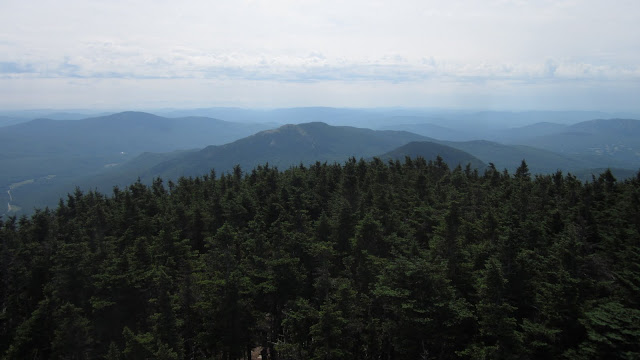
Roughly an hour and a half later we were a few thousand feet higher on Old Speck, enjoying the views. The Baldpates are seen to our west, where the A.T. continues toward its end on Mount Katahdin.
To the south is Sunday River.
To the east: the rest of the Mahoosuc Range, with the Presidentials on the horizon.
To the north: a bunch of stuff I'm not familiar with.
The view up top is aided by a converted fire tower...
...accessed by a steep ladder.
After leaving the summit, we drop down some steep ledges to Speck Pond.
There it is.
Typical White Mountain footing leads onward.
We got a little bit of a view into Mahoosuc Notch up ahead. Talus from the steep cliffs on either side fills the narrow pass with a jumble of huge boulders that we'll be going through.
Along the way we crossed a really pretty stream flowing wide and shallow across rock slabs.
The notch looms ahead and in we go.
Over...
...under...
...and through.
I imagine this is a bit more difficult with an overnight pack.
Looking up the walls of the notch:
Not a lot of sunlight makes it down in here and ice and snow lingers under many of the boulders. In fact, it feels almost air-conditioned and provides a welcome relief from the hot humid June day.
More cliffs. I hear they make for great back country ice climbing.
While the notch really isn't that bad, I can see how it would be very time consuming for backpackers. It's certainly a fun place to visit and worth a trip on its own merits. You certainly don't need to do a full traverse to get there.
After a long, steep climb, we got some really nice views from the open ledges on Fulling Mill Mountain.
I'm no weatherman, but those clouds don't look good.
We took short break at the Full Goose Shelter at mile 10-ish, to filter some water around 1:00 pm.
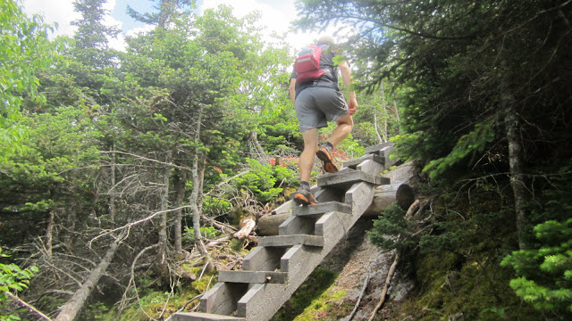
A little ways later we scrambled up some via-ferrata like stairs.
Back out in the open on some really cool trail through an alpine bog.
Up some interesting wooden stairs...
...and cool chicken-ramps.
The clouds continued to thicken and we heard thunder off to the north. Luckily, the storm held off while we were out in the open, but it didn't look like a good day to be above treeline on the Presis.
It's been a while since I got that "wow-factor" of a new place in the Whites, but running on Goose Eye certainly delivered. As usual, my words and pictures don't really come close to conveying the feeling as much as I'd like.
Near the top, the clouds rolled in a bit...
...partially shrouding the route ahead.
We then dropped below treeline for a while.
Some more ledgy scrambling, with occasional outlooks.
We arrived at the state line, not quite the halfway point, around 2:30 in the afternoon.
More alpine bog-bridgin' on Mount Success.
Descending to Gentian Pond around mile 20, we got a view of North Baldcap.
We made another stop to filter water near the pond at about 4:10 pm.
Finally, our number was up and the rain rolled in.
It was nothing we couldn't handle, but by now we were ready to be done.
The last ten miles are much more runnable, so the rain didn't cause too many problems over Cascade and Hayes Mountains and soon enough we were back to civilization. Somehow this wasn't the welcome I was expecting, but we slipped through unmolested.
The final stretch of trail lead over a bridge across the the Androscoggin River where my car was waiting.
We finished at about 8:00 pm, for a final time of 10:50, then had many more hours to retrieve the other car and drive home, finally getting to bed after midnight. Another long, long day, but worth it. I'm sure I'll be back.


Cool report and pics Adam. Another spot I need to visit in the future. Glad you made it out of the "Power Anal" untouched. I was worried...
ReplyDeleteGood luck at Hardrock, it has plenty of wow factor too.
ReplyDeleteNice long training....see you soon!
ReplyDelete