Friday, August 17, 2012

Tecumseh Thursday


Mighty Mount Tecumseh; the lowest and perhaps easiest of New Hampshire's 48 four thousand footers. This mountain was one of my first forays into peakbagging way back in the fall of 2003. Back then I was slower, heavier, and burdened with a backpack crammed with stuff. I didn't know what I really needed, so I just kept packing things in until the bag was full. Two liters of water, a ski parka, a half dozen flannel shirts, and a comically large digital camera. I sweat and panted and probably took four hours to do the 5 mile and 2,200 foot round trip, but I learned.


Almost nine years later (has it really been that long?) and I was back to visit Tecumseh for the umpteenth time. Though I was here only a few days ago, I decided to focus on just this one peak as an after work adventure. In many ways, the trip would be similar; I'd pant and wheeze and return to the parking lot feeling thoroughly worked - except this time I'd be trying to make the round trip in under 60 minutes. Rather than a 30 liter pack I'd have... a pair of shorts. And some shoes. And a tiny headlamp in my back pocket (you know, for safety).


Starting my GPS as I passed the trailhead sign, I rock-hopped across the stream that starts the trail, and ramped up to a full-on run. Normally I run much slower, at a pace that I can sustain all day and sometimes I find it difficult to differentiate between different grades of fast. Is this a half-hour race pace or a full hour race pace? Who knows? Just keep running. I probably went a bit too hard down low and ended up paying for it higher up when I had to walk a few of the steep sections.

Experiencing familiar trails at a hard run is very different from walking them, you almost experience the ground under a microscope. Your vision gets narrowed and you focus on the next few steps in front of you in close detail. Minor changes in steepness and footing take on a whole new meaning that I never got at a walking pace. Unlike some people, I won't try to say that any one pace is superior to another, they're just different. Sometimes I like to hike, sometimes I like to run, and sometimes I like to run as fast as I can.

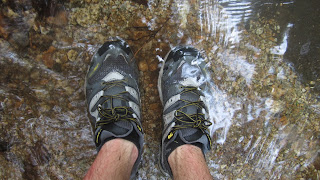
I tagged the summit cairn in 36:25 and immediately turned around to begin the descent. Running this kind of technical downhill is always fun and stimulating. It's a challenge to scan the ground ahead, planning out the next few foot placements and trying to ride the line between speed and control. I was wearing a new pair of New Balance MT1010s and was happy to find that they grip wet rock marvelously and still offer just enough underfoot protection for this kind of terrain while still being light and flexible. As the trail leveled out near the bottom I stole a glance at my watch and saw that things were going to be close if I wanted to go under an hour. Splashing through the stream crossings, I picked up speed and popped out of the woods and back onto the pavement, stopping my watch at the trailhead sign in 59:05.

Thirsty, sweaty, and satisfied, I got in my car to head home. A couch-free evening well spent.

Wednesday, August 15, 2012

Waterville Value Pack

Sometimes the only thing that makes any sense to me is running. Daily life is noisy and confusing. Running in the mountains is simple and quiet, where all I know is that I need to get from one place to another. Instead of work and chores and politics, I can just worry about weather, pace, fueling, and finding water. I'm in charge. I make all the decisions and there's no one there to second guess me or dictate what I can and can't do. There's no temptation to blame anyone else, either. I suffer my own mistakes.

The best thing for this is mountain loops. I prefer them 20-30 miles in length, with 8,000 feet or more of elevation gain and a few peaks along the way. Planned correctly, these loops scratch all the right itches. I get to revisit and explore, make thorough use of the day, blow off some steam, experience a little isolation, and get some training in. I can leave my car in one spot and return to it at the end of the day, no ride needed.

Last Sunday I put together another one of my loops, this time in Waterville Valley. The plan was to park at the Livermore trailhead and run up and over Mount Tecumseh to Tripoli Road, then pass over Mount Osceola and down to Greeley Ponds. From there, I'd link up a few connector trails over to Livermore Road, scramble up the North Slide on Mount Tripyramid, descend the South Slide and run back to the car. This totaled up to about 25 miles, 8,500 feet of gain, and five ranked four thousand footers.


The day started out rather wet and humid from the previous night's rain and I was drenched by the time I summited Mount Tecumseh. It had looked overcast from down in the valley but I got a few views from above the clouds near the top.


Off to the East, I could see the three peaks of Mount Tripyramid, with my afternoon route up the North Slide clearly visible.


The run down off Tecumseh follows an old logging road for part of the way, with good footing and a really mellow grade. A little over a mile on the dirt Tripoli Road and I was working my way up to the outlook on the main peak of Mount Osceola. Below, you can seen the connecting ridgeline that the trail follows over to Osceola's East peak.


Descending off East Osceola is kind of a pain in the ass. The trail is steep, rough, and slick and makes for some slow going down to Greeley Ponds.


At the ponds, the clouds had begun to part a bit and let some blue sky and sun shine through.


The Greeley Ponds Trail is in pretty rough shape after being washed out by Hurricane Irene last fall. The nearby river has been diverted in a few spots and turned the trail into a streambed.


I had to walk in the water for a few short stretches but otherwise didn't find it to be a big deal.


Here, I made something of a mistake. My original intention was to take the Flume Path and Old Skidder Trail over to Livermore Rd., but I got the urge to explore the Kancamagus Brook XC Ski Trail instead. Both trails go to the same place, so it shouldn't make much difference, right?


Shortly after the junction I found a few old buckets hanging on some trees. Leftovers from logging operations a generation or two ago.


The trail followed an old logging road and was pretty overgrown in many places, but not too difficult to follow. Often the ground was soft underfoot and I would squish through mud up to my ankles.


And then... the old road led into a swamp. One minute I was walking merrily along, the next I was thigh deep in a bog, trying to figure out how to get out without losing my shoes. The farther I went, the worse it got. I tried bushwhacking along the edge of the bog without much luck and was seriously considering turning around, but I only had about a 1/4 mile left to reach Livermore Road, so I ended up just struggling through. You know that scene in the Never Ending Story where the horse sinks into the bog? The experience wasn't far off that.


Finally back on dry land, expressing my regards for XC ski trails in the summer.


While the swamp kind of sucked, the North Slide is always fun. 1400 feet in a half mile up an old landslide? That's more my style.


Part way up the slide you hit some open slabs and can see back towards Tecumseh (left) and the Osceolas (right).


This trail has something of a notorious reputation among hikers but I think you'd be hard pressed to actually fall down it for any significant distance. The bigger danger comes from loose rock and I had to be careful not to dislodge anything on a few people I passed below.


By the time I topped out, I was running pretty low on water. I scooted down the South Slide and was happy to get to a clean stream near the bottom where I could refill my bottles before the last stretch of trail back to my car. Seven and a half hours of peace, quiet, and simplicity and I was ready to face the world again. 

Friday, August 10, 2012

Wasatch Wanderings

Every now and then my job sends me somewhere interesting, usually at the last minute. This time a call came on Friday night and by Tuesday morning I was on the ground in sunny Salt Lake City, Utah. While I'm kept pretty busy with work when on the road, I do usually manage to fit a few runs in. SLC is a great place for that, with good quality trails accessible right from downtown, as well as the Wasatch-Cache National Forest only a few minutes away.

And so it was, that I was able to hook up with a few other runners for a night run in Millcreek Canyon.


The famous "Boxing Bear" carved into an aspen tree in some high meadows many years ago by a shepherd named Frank.


I also managed to slip away long enough to run up Mount Olympus early in the morning. The Salt Lake valley sleeps below.


Sunrise on the summit.


Good mooooooorning, Utah!


The top was a cool place to hang out alone for a while. I wish I could have stayed longer and explored some more, but my flight home was calling.


As much as I like the West, there's no place like home. It's good to be back in New Hampshire.